Shale gas activities in Britain: results of a BGS-DECC study on the Bowland and Hodder shales in the North of England
 Prof. Michael H. Stephenson
Mike Stephenson, British Geological Survey
January 2014
On 27th June 2013 the results of a study on the Bowland and Hodder shales in the North of England were released by BGS (British Geological Survey) and DECC (Department of Energy and Climate Change) scientists in the presence of Ed Davey (UK Secretary of State for Energy and Climate Change) and Michael Fallon (Business and Energy Minister). The study considered resource (gas-in-place) of shale gas in an area between Wrexham and Blackpool in the west, and Nottingham and Scarborough in the east (Fig. 1). The estimate is in the form of a range to reflect geological uncertainty. The lower limit of the range is 822 trillion cubic feet and the upper limit is 2281 tcf, with a central estimate of 1329 tcf. This estimate is a resource figure (gas-in-place) and so represents the gas that we think is present, but not the gas that might be possible to extract. The proportion of gas that is possible to extract is unknown at present. It will depend on the economic, geological and social factors at each operating location.
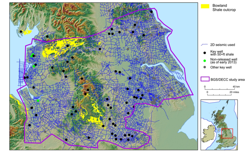 Fig. 1. Area and key data for the BGS-DECC shale gas resource estimate.
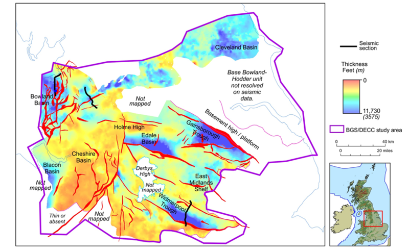 Fig. 2. Thickness of the Bowland-Hodder unit
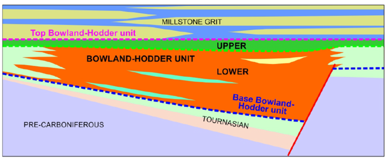 Fig. 3. Schematic of the upper and lower parts of the Bowland-Hodder unit
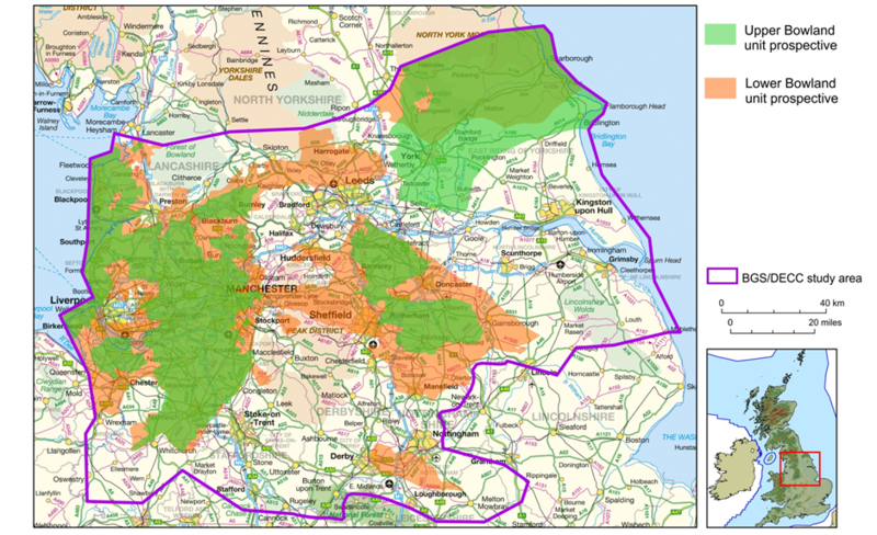 Fig. 4. The prospective areas.
Details of how the estimate was made are in the report but in brief the key to the estimate was to calculate the volume of shale in the chosen area. To get this BGS built a 3D static model using 64 key wells and 15000 miles of seismic, as well as years of data from shale outcrops. In the report the main lower Carboniferous shale unit (known as the ‘Bowland-Hodder unit’) was shown to be up to 5000 m thick in basin depocentres (e.g. the Bowland, Blacon, Gainsborough, Widmerpool, Edale and Cleveland basins; Fig. 2) and to contain quite high total organic carbon (TOC) levels (1-3%, but can reach 8%). The unit is known to be capable of generating gas because there are conventional gas fields in and around most of the basins, and offshore.
The Bowland-Hodder unit was deposited in rifting basins across central Britain during the Visean and Namurian. Some of the shales were deposited syn-rift, others post-rift. The upper post-rift part of the Bowland-Hodder unit is laterally continuous, with organic-rich, condensed zones that can be mapped, even over the platform highs (Fig. 3). There is also a lower underlying syn-rift unit, expanding to thousands of metres thick in fault-bounded basins, where the shale is interbedded with mass flow clastic sediments and re-deposited carbonates.
Following a calculation of the volume in cubic metres of the two components of the Bowland-Hodder unit we had to multiply by an estimate for the amount of gas that a typical cubic meter might contain. This and a Monte Carlo simulation gave us an in-place gas resource for the upper Bowland-Hodder unit of 164 to 447 tcf and a range of 658 to 1834 tcf for the lower thicker unit. The map below (Fig. 4) shows the prospective parts of the lower and upper Bowland-Hodder unit superimposed.